Saturday 25 November 2017

A Welsh Weekend Adventure - 2 - Pen y Gwryd to Glyder Fawr

Between the rugged defile of Pen y Pass and the wild spaces of the Ogwen Valley rises the ridge of peaks known as the Glyderau or Glyders. The area is as rocky and precipitous on the Ogwen side as it is rough and uncompromising on the other and includes such exciting routes as the Cribyn Ridge,
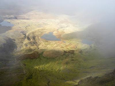
Nantgwynant Snowdonia
Wonderful view of the Nantgwynant
Bristly Ridge and Tryfan; some of the finest routes in Snowdonia. This route - which should not be underestimated for all its short distance - ventures though the rough terrain north of Pen y Pass to reach Glyder Fawr, which at 3279 ft or 999 m marks the high point of the ridge.

The second day of this short adventure in Snowdonia began with a chilly morning the campsite at Capel Curig; the previous night's rain and wind had given way to clear skies and temperatures of minus 2 to 3 degrees Celsius around dawn, leaving my micro camper coated in a layer of ice. After shivering through breakfast, I made the short journey to Pen y Gwryd and the cold began to give way to a day of glorious autumnal sunshine as I set out for Pen y Pass. Why didn't I drive up and park there?
pen y gwryd to pen y pass
The start of the path to Pen y Pass
Because it's £10 a day if you can get a space as opposed to £4 near Pen y Gwryd and free a quarter mile down the road.

For that same reason a few Snowdon-bound hikers were walking up the road but far preferable to that is the footpath from just opposite the bus turning area just past the hotel. It's an easy well made path that brings you out at the car park but also gives a false sense of security about what's to come...

After crossing the road, a path leads up on the opposite side; steeply at first before easing into grassy terrain and becoming less distinct as the lonely tarn of Llyn Cwmffynon is seen on the right. It's hard to believe here that the road is so close behind as we seem to have entered the wilderness here but most of the walkers from Pen y Pass are heading up Snowdon on the other side of
walking route in snowdonia - glyder fawr
Snowdon (2nd from R) and its range from the rest stop 
the valley.

A boggy area was met after a slight descent and the path faded in and led me me generally straight on (in a north westerly direction) with the tarn on my right, until it faded out of existence altogether and my way led through rough country, gradually climbing towards the ridge line ahead. Vestiges of a path here and there are probably little more than sheep tracks and it's more a case of finding the driest route, which eventually led me to bear left, (more to the west) up the rough slopes towards the higher ground.

The tussock grass, bogs and low rocky outcrops make for hard going and if you plan to do this route, when you reach the boggy depression
the glyders ridge snowdonia
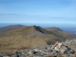
Y Garn and the sea from the top of Glyder Fawr
near the tarn, bear more to the left where a more distinct path does appear. It's no drier in the lower sections but is much easier to follow and was to be my descent route.

When it seemed as though the struggle uphill would go on forever, there was a sudden change in the terrain; the steeply sloping rough country through which I had been travelling, opened out and a path led northwards over a gently sloping plateau towards the summit of Glyder Fawr which didn't now look so far away. A short rest followed by an easy walk, led me in warm autumn sunshine to the stony crown of the Glyders where the landscape changed yet again into one of shattered boulders and grey tors that stood up high above their surroundings. One of these indeed made the highest point of the peak at 999 metres or 3279 feet and was reached by an easy scramble up.
views of snowdonia
Rock formations on the summit

This is a wonderful viewpoint on a day like this and the short video below has an all round summit panorama, which includes Glyder Fach and Tryfan eastwards along the ridge, Y Garn in the opposite direction and the Snowdon group rising to the South. My descent route retraced my steps off the summit to where I had reached the plateau but I continued more to the West to follow the top of this broad ridge down. Eventually a more consistent path was reached that I followed down over steep ground at first and then once again over the wet terrain to my start point.

This is a short route from Pen y Pass being a return journey of just 7 km which increases to 11 km (7 miles) if started from Pen y Gwryd.  The
south east from the glyders
Looking towards the start point from near the summit
additional distance from there just adds a pleasant walk to the harder going of the off path sections as well as saving at least £6 off parking which can be converted into beer at the pub - but not if driving! The total ascent is about 725 m from Pen y Gwryd and 650 m from Pen y Pass. There's also an option to follow the ridge to Glyder Fach and descend by a good path via Llyn Caseg-fraith to Pen y Gwryd, which is a walk of just over 11 km though the section between the two Glyder peaks is very rough going with boulders and a short scramble to negotiate. In these hills, modest distances can be deceptive.

On balance the best way up Glyder Fawr is by the Cribyn Ridge from Llyn Ogwen on the northern side, descending by the Devil's Kitchen path. I'll post that on here when I do it again though there is a description of the walk from the last time. Looking at the date on there I'd say it was about time I did it again as it was good.

Check out a glorious day on the Glyders - well worth it for the summit views...


If you missed it, here's the Day 1 post...
  The Wild Side of Snowdon

and here's the film of day one in some very different weather - check out the Dr Who time vortex effect near the end...


Monday 13 November 2017

A Welsh Weekend Adventure - 1 - The Wild Side of Snowdon...

The last weekend of October saw me heading back to North Wales for another short adventure in the
mountains of Snowdonia. It was a chance to make a couple more videos and try out my new camping setup in out of season conditions, though while the first night's storms posed no problem in the micro
climbing snowdon north wales
camper, (some people did struggle under canvas) the minus two Celsius recorded on the second night was decidedly chilly and required double sleeping bags. My chosen site was Dolgam at Capel Curig - a long time favourite of mine and the chosen objectives were Snowdon by the South Ridge and Glyder Fawr from near the Pen y Gwryd hotel. Also worth a mention are the fish and chips from the Old Shop in Betws Y Coed - an integral part of my outings here.

Below is detailed day one of the weekend, with a link today two to day two at the end. Posts here will now include - as well as the usual photos - video clips I made on the way which can also be viewed at my new You Tube channel. Enjoy...

The route from Rhyd-Ddu up the South Ridge of Snowdon is probably my favourite way to the top of
snowdon from the south
Snowdon from Rhyd-Ddu
the the highest mountain in Wales; it's varied and interesting and finishes with the exciting but problem-free ridge of Bwlch Main leading on towards the summit. Also, the crowds of tourists who don't take the train usually climb Snowdon from Llanberis or Pen y Pass and avoid this much quieter and wilder side of the mountain. My descent was by the route called the Rhyd Ddu path which lies a little to the west of the ascent route.

Having left my camp at Capel Curig I arrived at Rhyd-Ddu not far from the village of Beddgelert. Leaving the car park (£5 per day) I set out crossing the Welsh Highland Railway and in five minutes turning right through a gate to the open mountainside. A wide and easy path soon led to a fork in the trail where the Rhyd-Ddu path leaded left - this would be my descent route - and I headed straight on directly towards the obvious col or saddle between Snowdon and the lower peak of Yr
Mining was once in evidence here
Aran.

Just before the col, the path is overlooked by ruined stone buildings that resemble something out of a Tolkien novel, but they are actually remnants of the quarrying and mining industry from this region's past. Also evident are several deep chasms that show evidence of quarrying but beware - some of these are around a hundred feet deep so don't fall down one! The path itself is safe though and soon leads to the col where I had some food and water behind the wall and out of the chilly breeze, before continuing the journey. From the col the main path is seen coming up from Bethania and if you start from there, returning by the Watkin Path would be another good circular hike. For reference, the col between Snowdon and Yr Aran is at about 510 m or 1700 feet.

North Wales Views
Views on the South Ridge
The ascent of Yr Aran (747 m) to the south is also well worth the effort but my route headed up the South Ridge on a good path with stone steps up the early steep parts of the slope. It was only once up here, that I saw the first other hikers of the day, milling around on the col where I'd just rested. This really is the wild side of Snowdon and following the easy path as it climbs the ridge one can really appreciate one's surroundings in peace and quiet which would be less easy on the more popular trails.

About half way up, a rocky step in the ridge is reached that is surmounted by an easy scramble over the rocks on its left (western) side. The way is obvious and adds some excitement to the route though it's not difficult. Above the ridge continues in easy fashion with ever expanding views far to the south and closer up of the rugged heart of
Y Lliwedd from the South Ridge
Snowdon and its surrounding peaks. My own views were increasingly obscured by lowering cloud and some light rain showers at this point, though the weather cleared slightly as I reached the end of the Bwlch Main ridge at about 3050 feet.

Here the character of the walk changed again and a narrow crest led on towards the summit of Snowdon which was still obscured by cloud somewhere ahead. This is the best part of the walk and while on first sight it might look daunting from some aspects, there is a good path and even on the crest the way is without difficulty, though after winter snow this would not be the case.

hiker on snowdon
Hiker on the Bwlch Main
The Rhyd-Ddu path climbed up the slope to the left to join my route at the start of this section and the two routes converged to cross the Bwlch Main. At the far end a stone pillar marks the descent by the Watkin Path and the Snowdon Horseshoe route where it continues via Y Lliwedd to Pen y Pass. A rough but steady climb now brought me up the last couple of hundred feet to where the summit station of the Snowdon Mountain Railway appeared out of the swirling mists. Just beyond the station and its attendant crowds of tourists rose Y Wyddfa, the highest point of Wales at 1085 m or 3560 feet above sea level, which is attained by rocky steps behind the station. I might have had the trail to myself but not so the summit,
snowdonia national park views
Looking down from Bwlch Main
and I now shared this lofty belvedère with both fellow walkers and train passengers who had arrived here by the power of steam.

The view had vanished but the winds of Snowdon were producing a strange effect; a tunnel through the cloud had appeared on the eastern side of the peak that brought to mind the time vortex in Doctor Who - if you watch the video you will see what I mean. It was likely caused by the wind channeling over and around the peak and when Clara Oswald failed to appear, I decided to make my way back down.

My descent route today lay back over the Bwlch Main ridge and down to the right at its far end on the Rhyd-Ddu path where it joined my ascent route. This path - as its name would suggest - leads back to Rhyd-Ddu this time down the ridge known as
cwm clogwyn north wales
The Wild Side of Snowdon
Llechog which is a broad and stony shoulder of the mountain that overlooks the wild Cwm Clogwyn to the north. This path can also be used in ascent though I prefer doing the circuit this way around as the South Ridge is the more interesting way of the two. In total the walk is about 12 km with just over 900 m of ascent and descent.


Waiting to see if the Tardis would appear!


And here's Day 2...
 Pen y Gwryd to Glyder Fawr

and the film of day 1 - check out the Dr Who Time Vortex effect near the end...