During moments of clear weather as one heads north along the A82 from Tyndrum towards Rannoch Moor and Glencoe, a vast pyramid shaped mountain makes its presence felt ahead towering above the small hamlet of Bridge of Orchy. More often than not all you will see is mist and rain but the peak is called Beinn Dorain and is a Munro of over 3500 feet in height. Along with Ben More above nearby Crianlarich, I'd had a mind to climb the mountain for some time having driven past it many times so one fine day in summer I stopped at Bridge of Orchy instead of driving past...
From opposite the free car park by the hotel a lane leads up past the railway station and under the line where the West Highland Way path is crossed. That much celebrated trail leads north into the vast
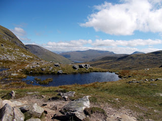
emptiness of Rannoch Moor but my way was east, along a path that followed a stream that here tumbled down from the mountains. The sun shone warmly as I followed the good trail towards the bealach or col that connects Beinn Dorain and Beinn an Dothaidh - the peaks that make up the barrier like mountain wall east of Bridge of Orchy. At my back was the wooded Glen Orchy while away off to the north the Blackmount Range rose above Rannoch Moor. I read somewhere that the Scottish Highlands is the least populated area of Europe and looking at this view that's very believable. The slope was gradual and the terrain gentle as I crossed the heather and grass moorland towards the mountain and presently as it was
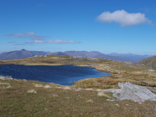
My way now led to the right or south; up over some rocky slabs which had an alpine feel to them in places and led to another higher tarn with some amazing views over Rannoch Moor to the Blackmount, the Glencoe Hills and distant Ben Nevis. From here there is no sign of the soaring pyramid shape of Beinn Dorain seen from the road and instead the path crossed a moorland plateau before ascending again to where there were signs of things to come. From this top you can head straight on over the plateau towards Beinn Dorain but I opted to follow the path to the right that skirted the edge of the vast drop to Bridge of Orchy.
This path very soon became interesting - exciting even - as it contoured along just beneath the top of the western face of the mountain with steep drops to the valley and the road where I could see my start point by the hotel almost 3000 feet down. Nowhere was the trail hazardous but I was always conscious of the vast gulf of air to my right. After crossing a small boulder field - the only place you have to look for the trail - I climbed up a short steep section to reach what felt like the end of the earth. The mountain didn't go any further and I was looking down the defile towards Tyndrum from where I had viewed this peak so many times. After admiring the view a short while I followed the trail as it doubled back a short distance to the actual summit which I had actually passed just earlier.
The way back was the same though you can follow the path on from the summit back to the north though the ascent route has to be one of the best routes to a summit in the area. The Munro bagger has the opportunity for a quick and easy ascent of Beinn an Dothaidh too by carrying straight on at the lower tarn whereas my route was left down into Coire an Dothaidh. In all a hike of 12km or a bit under 8 miles if you go back the same way with no deviations. The high point is Beinn Dorain at 1076m or about 3530ft and the start point is just by the Bridge of Orchy hotel at 150m (about 500ft) or the train station if you have arrived by train or on the West Highland Way.


Oh...this sounds like one to do. I drive past it often.
ReplyDeleteIt's a great walk... took me long enough to stop and do it though!
DeleteI went over this web site and I conceive you have a lot of great info , saved to my bookmarks (:. check over here
ReplyDelete